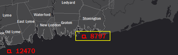
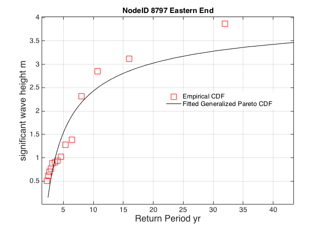
Eastern End
Latitude: 40.991
Longitude: -71.941
Depth: 11.423 m
| Storm | Date | % U max [m s^-1] | %U mean [m s^-1] | % U dir max | % U dir mean | % z(t) max [m] | % sigH maz [m] | % Tpeak max [s] |
| Gloria | Sept. 20, 1985 | 38.723 | 6.49 | 226.14 | 170.293 | 0.79 | 6.046 | 9.675 |
| Sandy | Oct. 25, 2012 | 27.1 | 9.86 | 74.261 | 92.032 | 0.53 | 4.447 | 8.068 |
| NorEaster | Oct. 30, 2012 | 33.099 | 11.74 | 75.75 | 92.013 | 0.642 | 2.99 | 7.368 |
| 1985 | month 9 | 13.375 | 5.356 | 70 | 152.73 | 0.519 | 1.083 | 4.274 |
| 2005 | month 9 | 9.024 | 7.136 | 78.947 | 189.954 | 0.591 | 0.643 | 3.564 |
| 2007 | month 4 | 16.484 | 7.445 | 105.589 | 223.554 | 0.786 | 1.457 | 5.611 |
| 2008 | month 8 | 22.802 | 8.776 | 319.918 | 220.815 | 0.528 | 2.434 | 6.729 |
| 2009 | month 8 | 8.283 | 4.642 | 142.588 | 196.277 | 0.627 | 0.742 | 3.564 |
| 2010 | month 9 | 11.976 | 5.834 | 27.91 | 225.711 | 0.789 | 0.537 | 3.255 |
| 2011 | month 8 | 21.576 | 7.972 | 164.313 | 162.385 | 0.553 | 3.272 | 8.068 |
| 2011 | month 10 | 17.271 | 6.746 | 22.23 | 156.638 | 0.586 | 0.949 | 2.714 |
| 2012 | month 10 | 27.1 | 9.86 | 74.261 | 92.032 | 0.484 | 4.06 | 8.068 |
| 2013 | month 2 | 21.039 | 14.456 | 38.461 | 200.265 | 0.56 | 0.989 | 4.274 |
| 2015 | month 1 | 19.689 | 8.756 | 6.096 | 215.561 | 0.596 | 0.923 | 2.714 |
| 2016 | month 1 | 23.035 | 13.768 | 61.11 | 108.436 | 0.181 | 1.068 | 3.564 |
Attribute Descriptions
| % U max [m s^-1] | maximum wind speed at that point |
| %U mean [m s^-1] | mean wind speed (average over time) |
| % U dir max | maximum wind direction |
| % U dir mean | mean wind direction |
| % z(t) max [m] | maximum sea-surface displacement … storm surge + tides |
| % sigH max [m] | maximum significant wave height |
| % Tpeak max [s] | maximum dominant wave period |