The results of the mapping tasks associated with the CREST project can be found in the Map Viewer.
There are four main sections of maps.
1. and 2. Old Saybrook Study Area and New Haven Study Area
Two 4-mile pilot areas were selected and studied in detail. Each area contains:
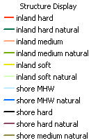 Detailed analysis of existing coastal structures, defined here as either shore or inland, either hard, medium or soft, and as either natural or not. MHW stands for Mean High Water.
- Shoreline photos were taken in high density along the two pilot areas and are indicated by a yellow dot
 . In the map viewer, click on each yellow dot to view the photo. Click on the photo itself to make it bigger.
To go directly to the study areas in the map viewer, look for this button ![]() in the upper right.
in the upper right.
3. Wave Nodes and NOAA Buoys
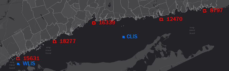
Five points distributed along the shore of Connecticut in Long Island Sound were chosen as locations for reporting results from the wave modeling work. They are shown by a red square ![]() and are numbered. There is a page for each point, 8797, 12470, 15631, 16339, 18277, as well as some information in the map when the point is clicked. The blue squares are two NOAA buoys.
and are numbered. There is a page for each point, 8797, 12470, 15631, 16339, 18277, as well as some information in the map when the point is clicked. The blue squares are two NOAA buoys.
4. Results Living Shorelines Site Suitability Analysis
Traditional methods of shoreline stabilization utilize hard structures such as sea walls, groins, and bulkheads, which have adverse environmental consequences. Shoreline “armoring” or the installation of these hard structural features can actually lead to an increase in erosion on adjacent properties and cause scouring in front of the armored shore, oftentimes negatively impacting beaches, fringing marsh and riparian habitats.
Living shorelines are an innovative and environmentally-friendly alternative to reduce coastal risk from both anthropogenic and natural causes of erosion. Living shorelines are nature-based shoreline protection strategies which also enhance natural habitat and ecosystem services.
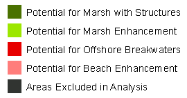 The Connecticut shore was analyzed for the potential success of four living shoreline methods: marsh enhancement, marsh with structures, offshore breakwaters and beach enhancement. A thorough explanation of the research and results, which includes interactive maps, can be found here.
The CREST Map Viewer contains layers showing more the model indicated the potential of a particular living shoreline technique.