 Sea Level Rise
Information on sea level rise and local projections for Connecticut

Reports, presentations, posters, and outreach materials

Interactive map viewer and technical tools

Coastal resilience research and planning projects

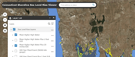
Featured Tool
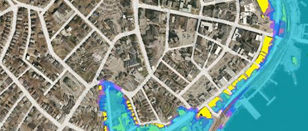
CT Sea Level Rise & Storm Surge Viewer
Map viewer showing two sea level rise projections (1 foot and 20 inches) above a MHHW along the Connecticut coast and the adjacent inland.
Featured Reference
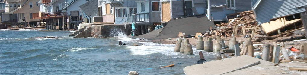
Sea Level Rise in CT
Final Report
Report describes why Connecticut should plan for up to 20 inches of sea level rise higher than the national tidal datum in Long Island Sound by 2050.
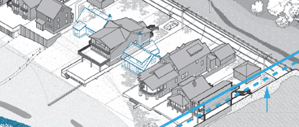
Featured Reference
Visualization Tools for
Sea Level Rise
Three resilience scenarios or drawings for communication and planning that depict sea level rise and flooding problems common in many coastal towns.
Featured Project
New London Sea Level Rise Planning Project
UConn landscape architecture team develops collaborative process, models, and design for coastal resilience along historic waterfront.