CIRCA’s mission is to help Connecticut’s towns and cities be more resilient to the impacts of climate change and extreme weather. In order to be more resilient, critical infrastructure within a municipality must be protected. CIRCA helps communities identify critical infrastructure that is at risk, measures the vulnerability, and identifies ways to reduce that vulnerability.
Below is a brief summary description of our current Critical Infrastructure projects. Click the Learn More button to read the detailed project description, or use the left navigation.

Advancing High Resolution Coastal Forecasting & Living Shorelines Approaches in the Northeast
The Advancing High Resolution Coastal Forecasting and Living Shorelines Approaches in the Northeast advances northeast regional forecasting for inundation from storms under future sea level rise scenarios and identifies policy barriers and potential solutions for the use of living shorelines in the northeast.

Clean Water Fund – EASE: Education and Action for Secure Energy
EASE (“Education and Action for Secure Energy”) is a focused program of education and technical assistance to help local decision makers in Connecticut plan for a secure supply of energy in extreme weather and other emergencies and to plan more broadly for local energy security and independence.

Drinking Water Vulnerability Assessment and Resilience Plan
The Connecticut Department of Public Health (DPH) and the Connecticut Institute for Resilience and Climate Adaptation (CIRCA) will work together for the purpose of preparing a Drinking Water Vulnerability Assessment and Resilience Plan to assess, identify, and address vulnerabilities for community water systems in Fairfield, New Haven, New London, and Middlesex counties. The Plan will utilize spatial data, flood risk, climate information, surveys and interviews with water utilities to ensure preparedness and resiliency of community water systems before, during, and after future storms and hazards, including the impacts of climate change and drought.
Municipal Resilience Planning Assistance for Sea Level Rise, Coastal Flooding, Wastewater Treatment Infrastructure, & Policy
The Municipal Resilience Planning Assistance for Sea Level Rise, Coastal Flooding, Wastewater Treatment Infrastructure, and Policy project provides information for wastewater system vulnerability assessments, combined river and coastal flooding for pilot sites, and policy options for priority resilience projects for towns in the Sandy-impacted counties.
New Haven Industrial Toolbox
The City of New Haven is a coastal town with repetitive flooding problems. In response to frequent flooding, the City organized the Program for Public Information, a committee charged with making recommendations to help address flooding issues.
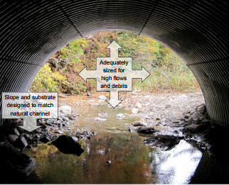
Oxford – Planning for Flood Resilient and Fish-Friendly Road-Stream Crossings in the Southern Naugatuck Valley
The Town of Oxford, in partnership with the Town of Seymour, will assess its road-stream crossings to identify undersized structures (looking at current and future climate conditions). In both towns, road-stream crossings are highly vulnerable to floods as well as potential areas for conscious, conservation-oriented development. The towns will work with several partners to identify priority crossings, in order to target their future mitigation efforts. Oxford and Seymour will develop pre-replacement plans for structures most at-risk, and prioritized based on flood damage risk, crossing condition and maintenance need, and habitat restoration value. The towns plans to collaborate with CIRCA for the culvert vulnerability modeling portion of the project.
Through this project the towns will also develop a road-stream crossing inventory and a management plan. The resulting planning documents will be adopted as an annex to each town’s Natural Hazard Mitigation Plan facilitating implementation of the identified mitigation responses.
Real‐time Flood Prediction & Vulnerability Analysis of Connecticut’s Inland River Network
The Real‐time Flood Prediction and Vulnerability Analysis of Connecticut’s Inland River Network project provides a hydrology model for Connecticut’s rivers and applies this model to determine flood vulnerabilities in current and future climate scenarios.
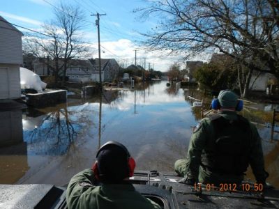
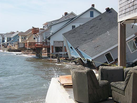
Road Flooding in Coastal Connecticut
The coastline of Connecticut is characterized by numerous inlets where the rivers and streams carrying runoff from land towards the ocean and the saline tidal waters of Long Island Sound intrude into the channels.

Scoping of Dredge Material Islands & Wetlands for Green Infrastructure Resiliency
The Scoping of Dredge Material Islands and Wetlands for Green Infrastructure Resiliency Projects Along the Connecticut Shoreline in Fairfield and New Haven Counties project will provide design guidelines and a regulatory framework for creating wetlands from dredge materials in Connecticut to increase shoreline resiliency.
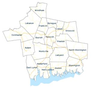
SCCOG – Southeastern Connecticut Critical Facilities Assessment
The Southeastern Connecticut Council of Governments (SCCOG) conducted an assessment of 18 community facilities located in or near flood zones that are critical for ongoing public services, including fire and police stations, town halls, and departments of public works. The assessment identifies the risks to properties and service continuation from flooding, wind damage, and snow loads now and over the next several decades. For each site, the assessment recommends appropriate flood prevention measures, potentially including relocation, site modifications such as flood walls, flood proofing, and elevation of utilities.
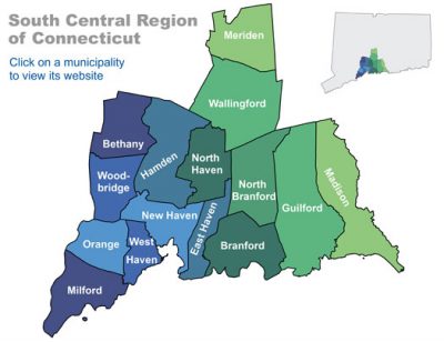
SCRCOG- Climate Adaptation and Resiliency Planning for Protection of Public Drinking Water
In this project the South Central Regional Council of Governments (SCRCOG) will integrate climate change information into water planning processes for the region as well as develop an adaptation plan for this essential sector for the SCRCOG region and the South Central Connecticut Regional Water Authority.
With changing precipitation patterns, sea level rise, and drought anticipated due to climate change, water resource managers will benefit from integration of climate data into planning. The SCRCOG will work with regional planners, utility water managers, and climate science experts to identify climate risks and thresholds of importance to the regions water utilities, conduct a historical climate data analysis for the region, and prepare/analyze future climate projections and impacts. Using a scenario approach SCRCOG will assist water utility managers as they incorporate this data into planning activities.
SCRCOG will also create a guide for other regional entities and/or municipalities considering integration of climate change data into planning efforts.
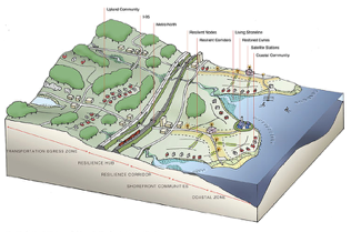
SCRCOG – Design and Technical Guide for Implementing Innovative Municipal Scale Coastal Resilience in Southern Connecticut
Coastal adaptation and resilience planning at the municipal scale faces multiple challenges including concerns with the tax base, lack of decision support tools, and gaps in valuing urban ecosystem services. This CIRCA grant project seeks to overcome challenges that practitioners, planners, and policymaker’s encounter by using coastal adaptation strategies applied to projects in Old Field Creek in West Haven and Cosey Beach in East Haven. These two projects build on past efforts of the Regional Framework for Coastal Resilience in Southern CT and the Yale Urban Ecology Design Lab (UEDLAB) project funded by The Nature Conservancy.
Sites in West and East Haven are at different stages in planning and each is distinct in population density, hydrology, erosion and wave patterns, and types of habitat. Building on previous experiences and findings, a core group of landscape architects, regional planners, land use attorneys, economists, and engineers will work closely with the municipalities to create initial design proposals and leverage the planning process developed as part of the Regional Framework for Coastal Resilience. Outcomes will include a Design and Technical Guide based on evaluation from an Economic Analysis/Decision Making Support Tool. The Design and Technical Guide will be integrated into the municipal planning process. These outcomes will help transition municipalities driven by hard infrastructure, road transportation and developer-driven housing to spaces created with equity, human health, ecosystem function, and climate change as drivers of planning and design.

Stamford – Resilience Opportunity Assessment
The City of Stamford was awarded a CIRCA grant for its “Resilience Opportunity Assessment” for a pilot project to review the potential vulnerability to climate change hazards at the Stamford Government Center and Stamford High School. Government Center is where the majority of City operations are housed the school is one of several locations serving as a public emergency shelter during blackouts and storms. The City is partnering with New Ecology, Inc., a Hartford-based non-profit that has developed a resilience assessment process for identifying hazards (including flooding, erosion, drought, extreme heat and cold, storms, fires, etc.) and implementation priorities (including but not limited to: elevating mechanical and electrical equipment, flood proofing buildings, flood barriers, perimeter drains, backflow preventers, portable water storage, etc.). The product of this CIRCA Municipal Resilience Grant will be a set of recommendations for mitigation approaches ranked in terms of cost, risk, and vulnerability for these two buildings. This pilot assessment will not only provide an opportunity to advance resiliency in specific municipal buildings, but an opportunity to improve how the entire City functions and recovers from possible disaster.
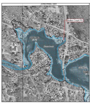
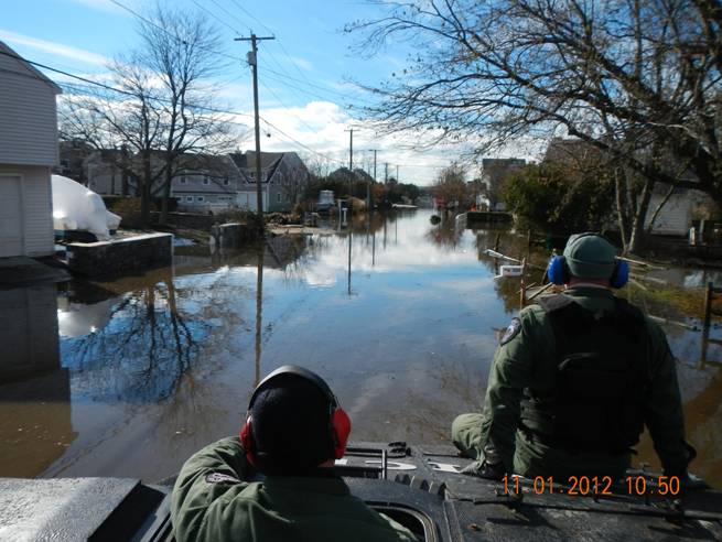
Waterford Municipal Infrastructure Resilience Project Sewer Pump Station Assessment and Adaptation
The Waterford Municipal Infrastructure Resilience Project is a two-part project that assesses the vulnerabilities of the town’s sewer pumps stations as well as an analysis of drainage at Gardiners Wood Road. The flooding Waterford has been receiving during recent storms has caused disruptions to multiple pump stations, demonstrating the need for repairs.