 Inland Flooding
Projects Related to Inland Flooding
CIRCA focuses on understanding characteristics and trends of changing precipitation patterns and their influence on inland flooding in riverine communities using tested hydrologic models. In coastal areas where there are also rivers, rainfall contributes to flooding in coastal communities as well, packing a one-two punch.
Below is a brief summary description of our current Inland Flooding projects. Click the Learn More button to read the detailed project description, or use the left navigation.
Community Rating System (CRS) – Municipal Assistance for FEMA
The Federal Emergency Management Agency (FEMA) administers the National Flood Insurance Program (NFIP) to provide flood insurance within communities that adopt and enforce floodplain regulations. Communities may choose to enter into the National Flood Insurance Program’s Community Rating System (CRS) in order to reduce the cost of flood insurance premiums for their property owners. Communities participating in the CRS Program go above and beyond the minimum standards and, depending on their level of mitigation efforts, can garner insurance premium reductions from 5-45%.

Hartford – Green Infrastructure Specialist for a More Resilient and Sustainable Future
The City of Hartford received grant assistance from CIRCA to hire a Green Infrastructure Specialist for 12 months in support of the city's climate resiliency effort – the Climate Stewardship Initiative (CSI). Through the CSI, Hartford and its collaborators are making strides in five action areas (energy, land, transportation, waste, and water). The Green Infrastructure Specialist will help Hartford respond to threats of flooding while evaluating and advancing green infrastructure projects.
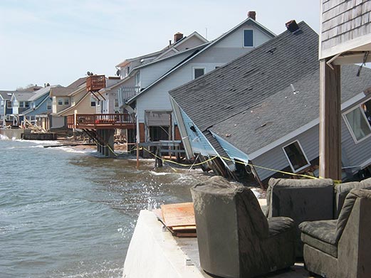
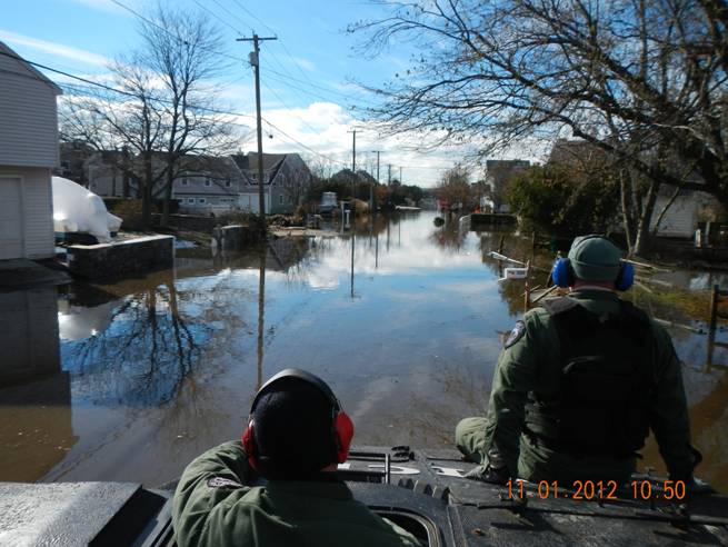
Municipal Resilience Planning Assistance for Sea Level Rise, Coastal Flooding, Wastewater Treatment Infrastructure, & Policy
The Municipal Resilience Planning Assistance for Sea Level Rise, Coastal Flooding, Wastewater Treatment Infrastructure, and Policy project provides information for wastewater system vulnerability assessments, combined river and coastal flooding for pilot sites, and policy options for priority resilience projects for towns in the Sandy-impacted counties.
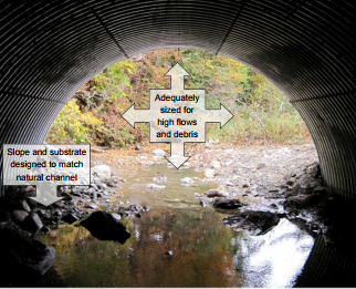
Oxford – Planning for Flood Resilient and Fish-Friendly Road-Stream Crossings in the Southern Naugatuck Valley
The Town of Oxford in partnership with Town of Seymour, Housatonic Valley Association (HVA), UConn/CIRCA researchers, and Princeton Hydro LLC are working to reduce flood damage risk and improve river and stream habitat connectivity in the lower Naugatuck Valley by integrating climate change resilience into the management of road-stream crossings. Through this project the towns are developing a road-stream crossing inventory and a management plan.
Real‐time Flood Prediction & Vulnerability Analysis of Connecticut’s Inland River Network
The Real‐time Flood Prediction and Vulnerability Analysis of Connecticut’s Inland River Network project provides a hydrology model for Connecticut’s rivers and applies this model to determine flood vulnerabilities in current and future climate scenarios.
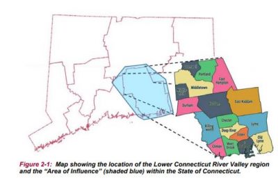
RiverCOG – Regional Long Term Recovery-Land Use Resiliency Plan
The RiverCOG developed a Regional Long Term Recovery and Land Use Mitigation Plan for its 17 towns based on real-time data and forecasts, mapping, and best management engineering practices for infrastructure (transportation, water, wastewater, utilities) as they relate to resilience in land use policies and climate adaptation. The Plan creates a template for towns to incorporate land use and infrastructure policies that will improve resiliency from natural hazard events and a strategy for long term recovery efforts.
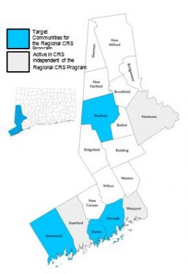
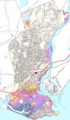
WestCOG – Regional CRS Program
Western Connecticut is extremely vulnerable to natural hazards. Many of its most critical assets including public safety, sanitation facilities, transportation corridors, employment centers, and affordable housing are located on or near the coast or the region’s many inland waterways. Using a CIRCA grant, WCOG is taking steps to create a regional CRS program and specifically assist four municipalities as they take on mitigation efforts to reduce the impacts of coastal and riverine flooding. WCOG is helping to provide cost savings by performing CRS activities and CRS municipal coordination at a regional scale.