 Critical Infrastructure
Projects Related to Critical Infrastructure
CIRCA’s mission is to help Connecticut’s towns and cities be more resilient to the impacts of climate change and extreme weather. In order to be more resilient, critical infrastructure within a municipality must be protected. CIRCA helps communities identify critical infrastructure that is at risk, measures the vulnerability, and identifies ways to reduce that vulnerability.
Below is a brief summary description of our current Critical Infrastructure projects. Click the Learn More button to read the detailed project description, or use the left navigation.

Advancing Priority Culvert Right-Sizing Projects in the Naugatuck River Watershed
Assessment 521 road-stream crossing structures using the North Atlantic Aquatic Connectivity Collaborative (NAACC) protocol, and conducted additional assessment at close-bottomed structures (culverts) to support flood risk modelling by our partners at the University of Connecticut (UConn).

Clean Water Fund – EASE: Education and Action for Secure Energy
EASE (“Education and Action for Secure Energy”) is a focused program of education and technical assistance to help local decision makers in Connecticut plan for a secure supply of energy in extreme weather and other emergencies and to plan more broadly for local energy security and independence.

Drinking Water Vulnerability Assessment and Resilience Plan
The Connecticut Department of Public Health (DPH) and the Connecticut Institute for Resilience and Climate Adaptation (CIRCA) will work together for the purpose of preparing a Drinking Water Vulnerability Assessment and Resilience Plan to assess, identify, and address vulnerabilities for community water systems in Fairfield, New Haven, New London, and Middlesex counties.

Municipal Resilience Planning Assistance for Sea Level Rise, Coastal Flooding, Wastewater Treatment Infrastructure, & Policy
The Municipal Resilience Planning Assistance for Sea Level Rise, Coastal Flooding, Wastewater Treatment Infrastructure, and Policy project provides information for wastewater system vulnerability assessments, combined river and coastal flooding for pilot sites, and policy options for priority resilience projects for towns in the Sandy-impacted counties.
New Haven Industrial Toolbox
Flooding events can cause closures in New Haven’s commercial downtown area. In response, City officials organized the Program for Public Information in 2014 and formed a committee that was charged with making recommendations to help address flooding issues. One recommendation of the committee was to create and implement a New Haven Commercial Industrial Toolbox (CIT) to enhance resilience of the city’s commercial infrastructure by creating a manual to assist commercial property owners before flooding events occur
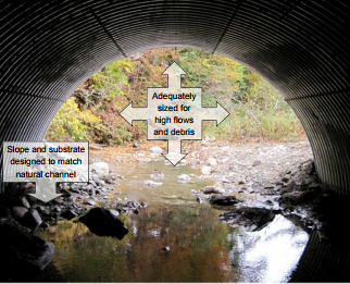
Oxford – Planning for Flood Resilient and Fish-Friendly Road-Stream Crossings in the Southern Naugatuck Valley
The Town of Oxford in partnership with Town of Seymour, Housatonic Valley Association (HVA), UConn/CIRCA researchers, and Princeton Hydro LLC are working to reduce flood damage risk and improve river and stream habitat connectivity in the lower Naugatuck Valley by integrating climate change resilience into the management of road-stream crossings. Through this project the towns are developing a road-stream crossing inventory and a management plan.
Real‐time Flood Prediction & Vulnerability Analysis of Connecticut’s Inland River Network
The Real‐time Flood Prediction and Vulnerability Analysis of Connecticut’s Inland River Network project provides a hydrology model for Connecticut’s rivers and applies this model to determine flood vulnerabilities in current and future climate scenarios.
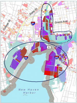
Road Flooding in Coastal Connecticut
The coastline of Connecticut is characterized by numerous inlets where the rivers and streams carrying runoff from land towards the ocean and the saline tidal waters of Long Island Sound intrude into the channels.
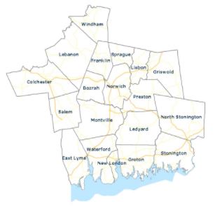
SCCOG – Southeastern Connecticut Critical Facilities Assessment
SCCOG conducted an assessment of 18 community facilities located in or near flood zones that are critical for ongoing public services, including fire and police stations, town halls, and departments of public works. The assessment identifies risks to these properties and service continuation from flooding, wind damage, and snow loads now and over the next several decades. For each site, the assessment recommends appropriate flood prevention measures, potentially including relocation, site modifications such as flood walls, flood proofing, and elevation of utilities.
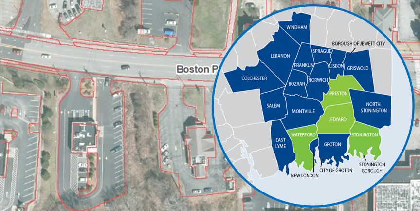
SCCOG – Southeastern Connecticut Municipal Stormwater Utility Feasibility Study
The Southeastern Connecticut Council of Governments (SCCOG) secured a Municipal Resilience Grant from the Connecticut Institute for Resilience and Climate Adaptation (CIRCA) to conduct a municipal stormwater authority feasibility study. Four SCCOG member municipalities, Ledyard, Preston, Stonington, and Waterford participated in the study due to interest in possibly forming a stormwater authority. In conjunction with the SCCOG, CDM Smith has been contracted to study the feasibility of establishing municipal stormwater authorities for these four municipalities.
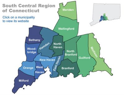
SCRCOG – Climate Adaptation and Resiliency Planning for Protection of Public Drinking Water
UConn researchers are working with the South Central Regional Council of Governments (SCRCOG) and the South Central Connecticut Regional Water Authority (RWA) to integrate climate change information into water planning processes for the region. With changing precipitation patterns, sea level rise, and drought anticipated due to climate change, water resource managers will benefit from integration of climate data into planning.

Stamford – Resilience Opportunity Assessment
The City of Stamford’s “Resilience Opportunity Assessment” is a pilot project reviewing potential vulnerability to climate change hazards at Stamford’s Government Center and High School. Government Center is where the majority of City operations are housed and the school is one of several locations serving as a public emergency shelter during blackouts and storms. This pilot assessment not only provides an opportunity to advance resiliency in specific municipal buildings, but is an opportunity to improve how the entire City functions and recovers from possible disaster.
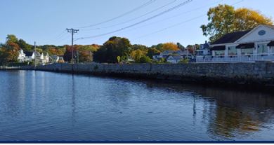
Stonington – Holmes Street Seawall
Holmes Street serves as an important collector road within Historic Downtown Mystic connecting local businesses, homes, and points of interest. An approximately 500-foot-long section of Holmes Street from the intersection with Bay Street and extending southwest past the intersections with Frazier Street is supported by a seawall along the western shore of the Mystic River. The existing seawall is in poor condition due to the age of the structure and scour due to rise in the water level and severe weather events.
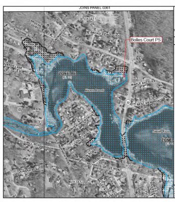
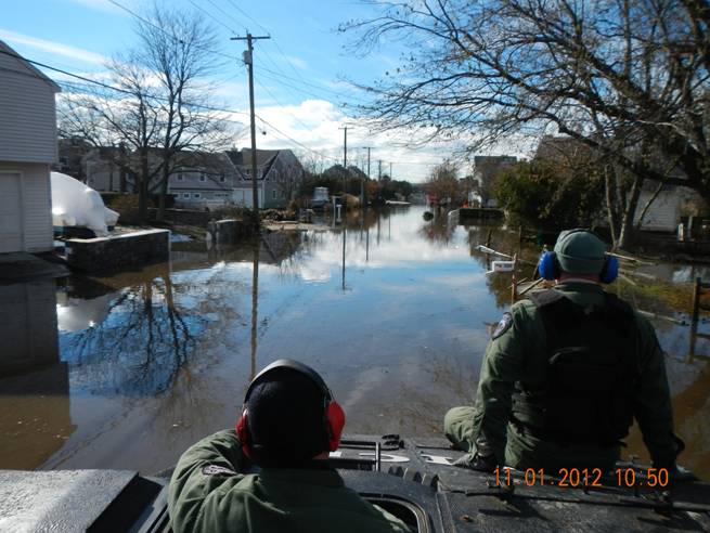
Waterford Municipal Infrastructure Resilience Project
The Waterford Municipal Infrastructure Resilience Project is a two-part project that assesses the vulnerabilities of the town’s sewer pumps stations as well as an analysis of drainage at Gardiners Wood Road. The flooding Waterford has been receiving during recent storms has caused disruptions to multiple pump stations, demonstrating the need for repairs. The pump stations evaluated are on the border, or within areas noted as having a high probability of inundation under certain sea level rise scenarios.